Warrington
Road, Birchwood
Warrington
Road, BirchwoodThe Old Main Road through Risley
Warrington
Road, Birchwood
The Old Main Road through Risley
| Contents
Page
Encounter All photographs on these pages are the property of the photographer Brian Tuohey. They may not be re-published in any form without written permission, but may be downloaded for personal use. Requests for commercial or charitable use of these or any other photographs will be considered. Please do not link directly to pictures, but links to this page are welcome. |
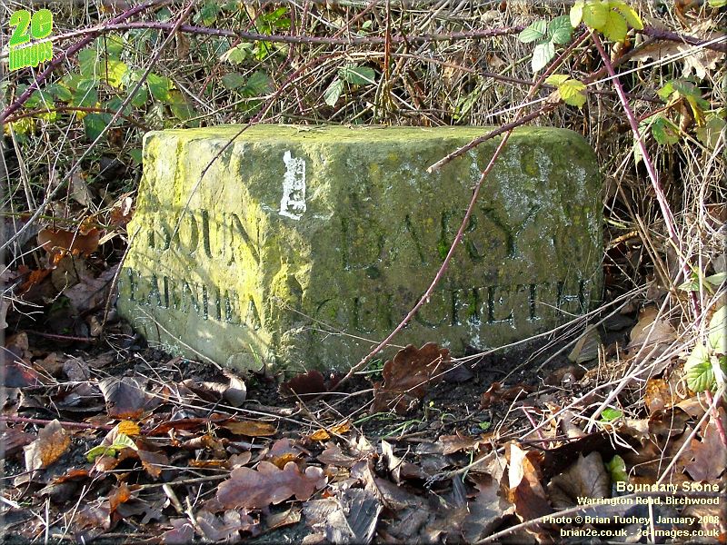
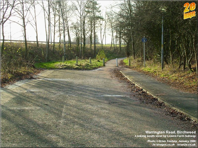
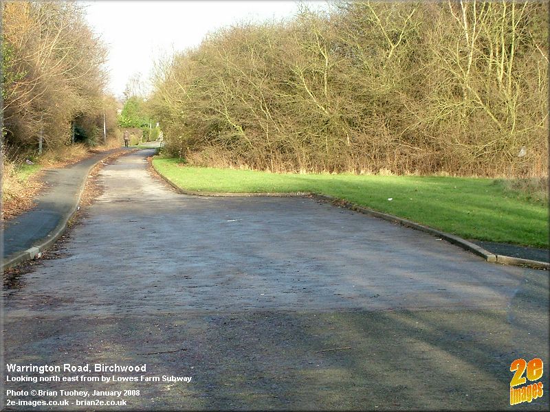
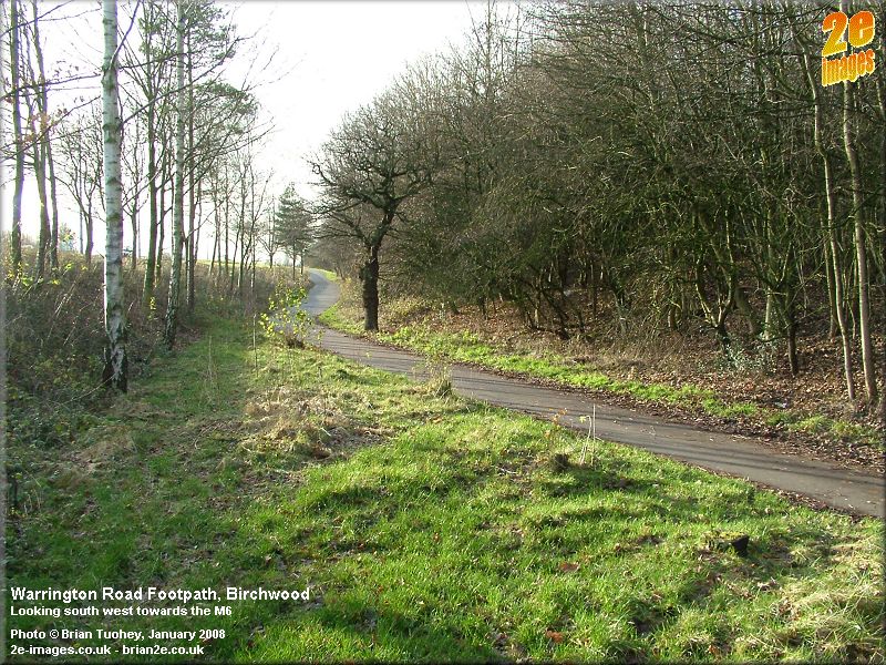
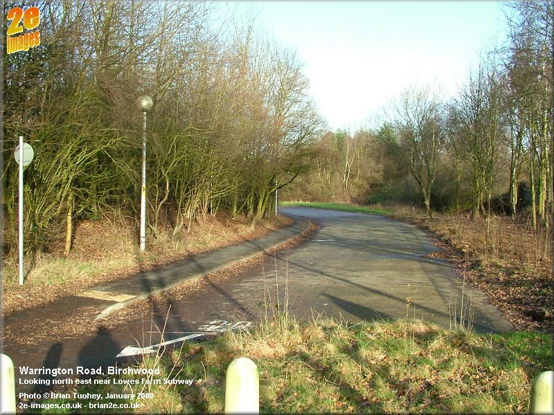
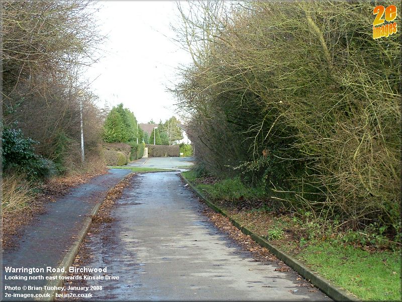
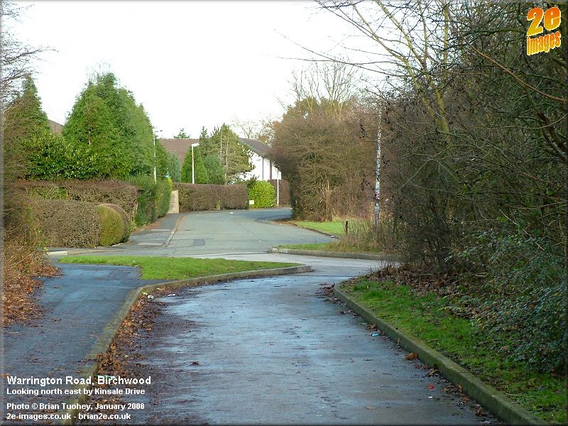
Introduction | M6 to Kinsale Dr | Kinsale Dr to Footbridge | Delenty Drive | Business Parks Introduction Warrington Road had always been the main road through the village of Risley, linking Fearnhead to the west with Culcheth to the north. It was the original route of the A574. In the rural farming days, there were few buildings, mainly farms and other houses as well as churches and inns. There were also several lanes off the road, mainly leading to farms or down to the moss. In the mid 1800s, it wasn't even called Warrington Road. At that time it was Risley Lane. As the road passes through the Risley and Birchwood area, the numbering of properties along the road is in the 600s and 700s, increasing towards Warrington. This might seem a little strange at first, but the explanation is that when Warrington Road was first named, Risley was a part of the civil parish of Culcheth which wasn't in Warrington at all, but in Leigh Rural District. Warrington Road begins in Leigh. In fact it finished at the boundary of Risley and Fearnhead where it became Fearnhead Lane. When the Royal Ordnance Factory was built in 1938-39, the character of the area changed completely. Many of the old farms and lanes disappeared and Warrington Road increased in importance as it became the main road serving the huge factory complex and later the UKAEA facility that was developed in the area. It was only when the new town area of Birchwood was developed in the 1970s and 80s that the importance of Warrington Road declined and parts of it began to disappear, being replaced and by-passed by new roads like Birchwood Way and Birchwood Park Avenue. Nowadays, it is not possible to drive along the whole of the old road. The journey below starts on the western edge of Birchwood at the M6 and travels north eastwards in stages finishing at the roundabout near the Noggin, just short of the northern edge of the district. Part 1 - M6 to Kinsale Drive This first section starts with the path down from the bridge over the M6 on Birchwood Way. In fact, this section of the old road was the end of Fearnhead Lane. On the left near the bottom of the hill once stood Lowe's Farm with a small pond next to it. It survived the factory days, being demolished only when Birchwood was created. Shortly after this, the path opens out and there is a subway under Birchwood Way named after the old farm. This area marked the original boundary between Fearnhead and Culcheth, Risley being the most southerly village within the old township of Culcheth. An old boundary stone can still be seen there today, and this is the point where the road became Warrington Road. There was an inn at this point, the Old Turf and Feather. There was also a New Turf and Feather nearby. The pub in Locking Stumps is at least the third building to use the name. The road continues, now a single track service road, until it passes the Scouts building and reaches the end of Kinsale Drive.
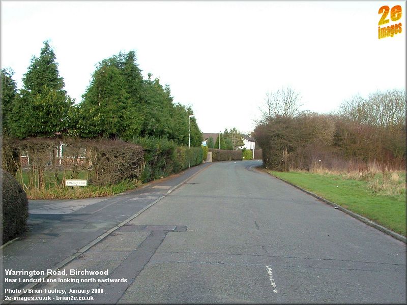
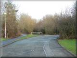
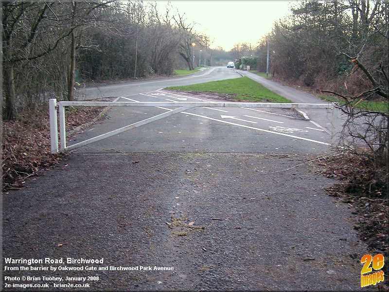
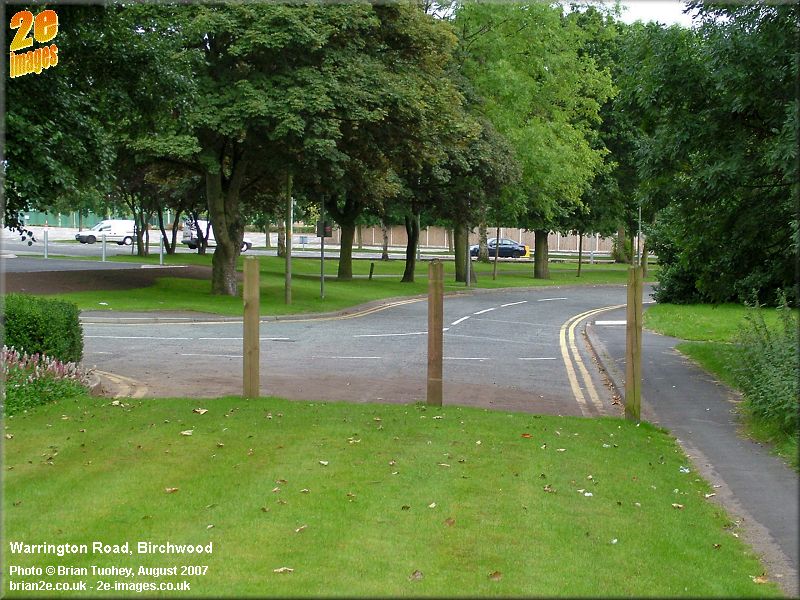
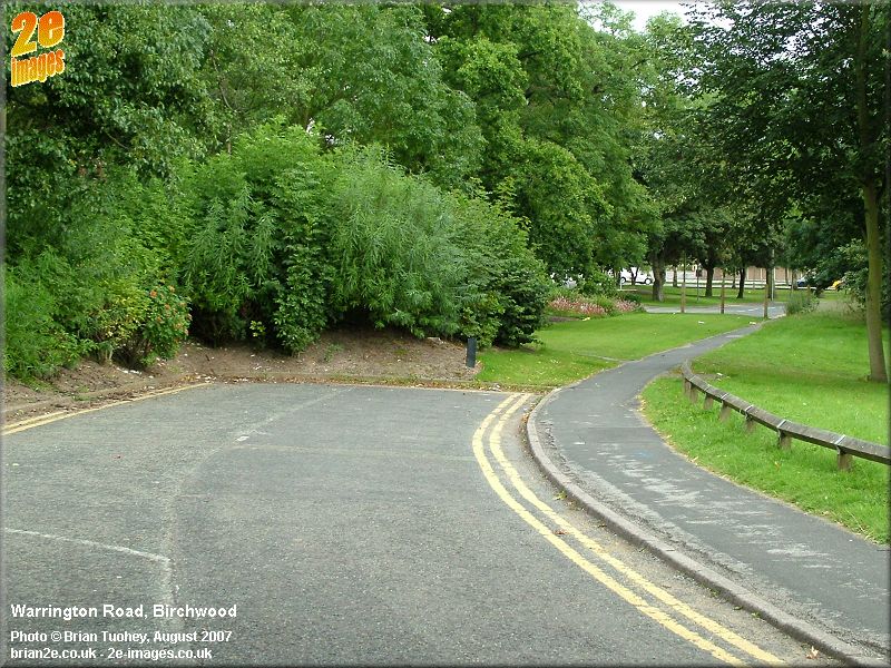
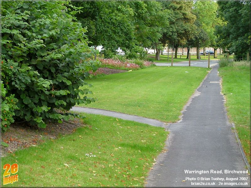
Part 2 - Kinsale Drive to Footbridge at Birchwood Park Avenue The end of Kinsale Drive sweeps round and leads into Warrington Road. This is now the original road. On the corner of Landcut Lane once stood an old Methodist Chapel, now relocated to Fearnhead Lane, but still retaining the name of Risley Independent Methodist Church. Their website indicates that they moved in 1910 and that they celebrated their bicentenary in 2006. Opposite Landcut Lane was Moss Lane, which marked the start of the Royal Ordnance Factory. The factory buildings that faced the road were mainly offices, including a Social Centre and administration buildings. The higher risk danger areas where all the filling was done were set back from the main road. On the left, between Robert's Fold and the path towards the shop, were the old Almshouses. I'm not sure whether any of the current properties were once almshouses, but the land is still very distinctly defined. On the right, there was a large lay-by at the factory which was used by the fleets of buses that carried many of the workers each day. There were several gates into the factory, but the main entrance, the Oakwood Gate, was at this point. Ahead, there is a strange abrupt end to this section of Warrington Road. The original course of the road was straight on through the barrier, and a short section of the original road continues past this point. The road appears to start turning to the right, by-passing the barrier and heading towards part of the "dog-bone" roundabout (George Duckworth Island) where Birchwood Way meets Birchwood Park Avenue. The OS 50K map of 1979 (2nd Series, Edition "A") shows exactly this situation. Birchwood Park Avenue had been opened and it joined this section of Warrington Road at the roundabout. Birchwood Way is not marked on the map, so at that time, Warrington Road was still the main road. This layout existed for only a few years. The path leading to the footbridge over Birchwood Park Avenue and towards the next section of the old road is just to the left of the barrier.
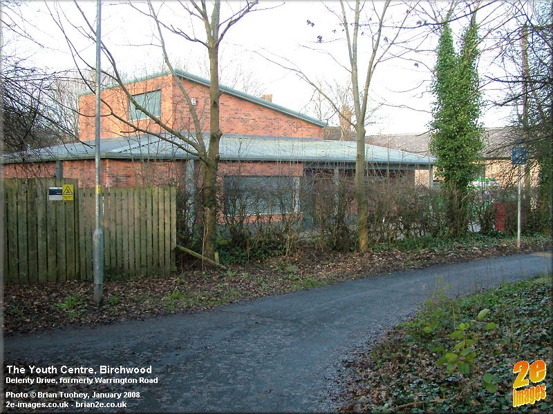
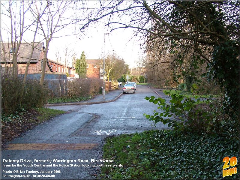
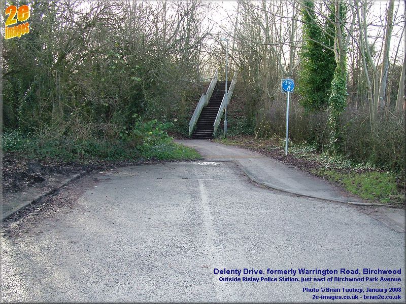
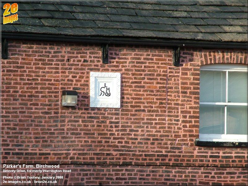
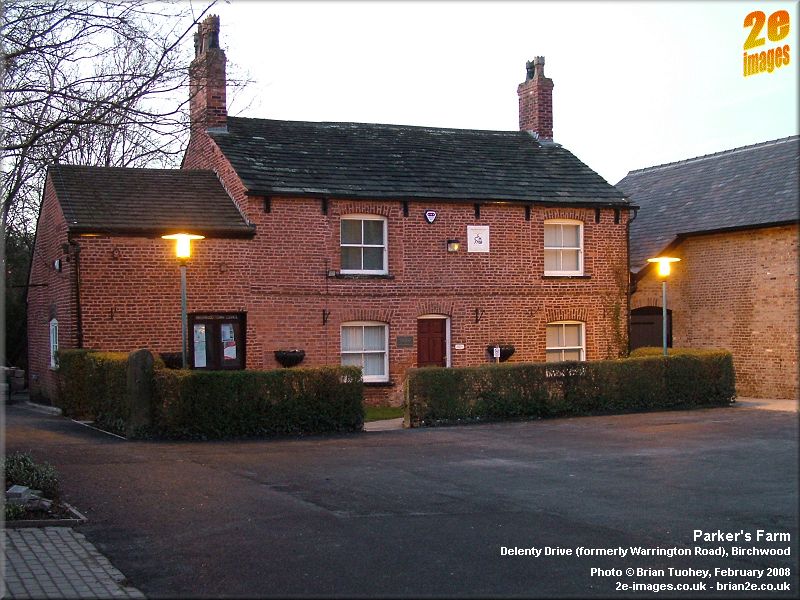
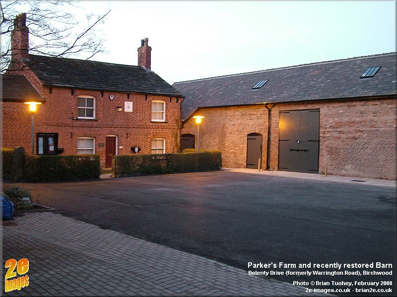
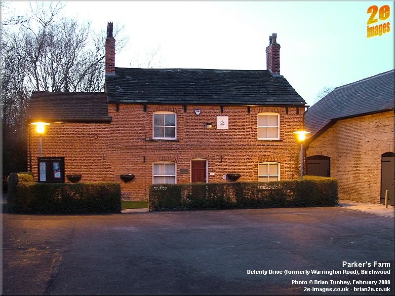
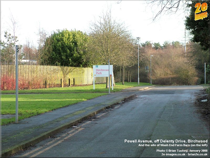
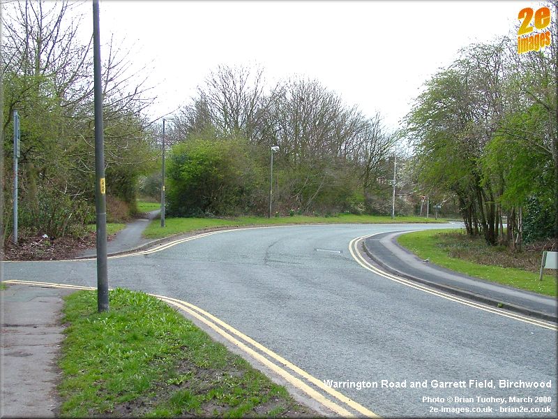
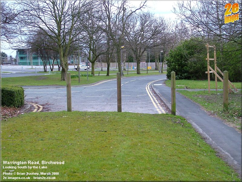
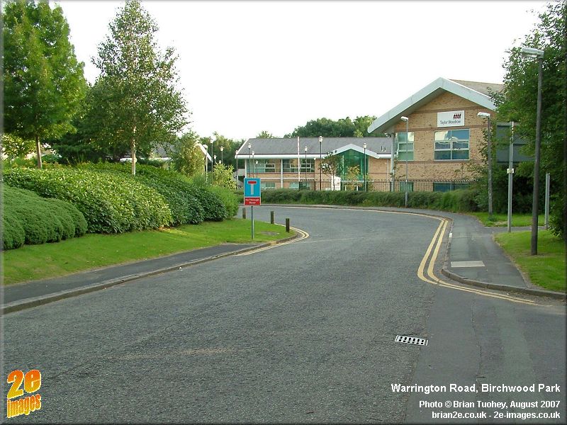
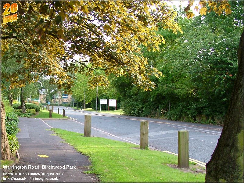
Part 3 - Delenty Drive to Garrett Field The footbridge leads to a section of the road that was renamed Delenty Drive. This short section has several buildings from factory and pre-factory days. On the left is the Youth and Community Centre, a modern building immediately next to Parker's Farm, which bears the date 1709. On older maps the building is marked as Clare Farm. It is now used as the offices of Birchwood Town Council. The adjoining barn was restored during 2007-08 and is now back in use. Opposite is Risley Police Station, which occupies one of a series of four buildings that appeared to have been homes or perhaps offices of senior staff at the factory. Of the other three buildings, one is behind the police station, another is in a derelict state alongside, and the third was demolished and modern housing now occupies the site. Also in this area is one of the few remaining pillboxes from factory days and Heathfield House, an old pre-war building that is now used as a nursery. The site of Wash End Farm is on the corner of Powell Avenue opposite Heathfield House. Its barn stood behind, on the grassy area in Powell Avenue. As well as being a UKAEA road, it was also the start of one of the pre-factory farm lanes. The row of houses beyond retain their Warrington Road identity. In factory days they were used mainly by police and fire officers. Beyond them, Garrett Field merges with old Warrington Road and continues as far as Chadwick House. Chadwick House is a post-war building, dating from the UKAEA period. Prior to then, Garret Farm (normally spelt with a single 't' in contrast to Garrett Field) occupied the area immediately in front of the building, including where the lake is today. By now, the road has entered the commercial area of Birchwood, with the Science Park largely to the left and Birchwood Park to the right.
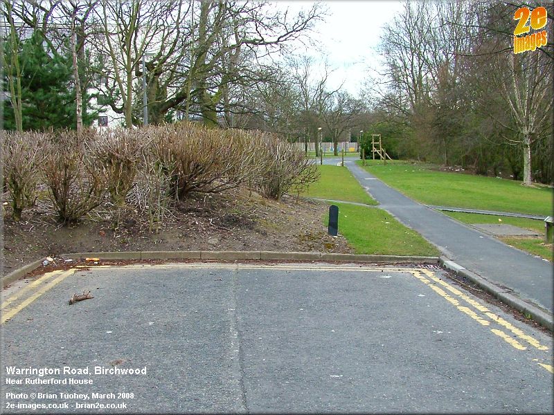
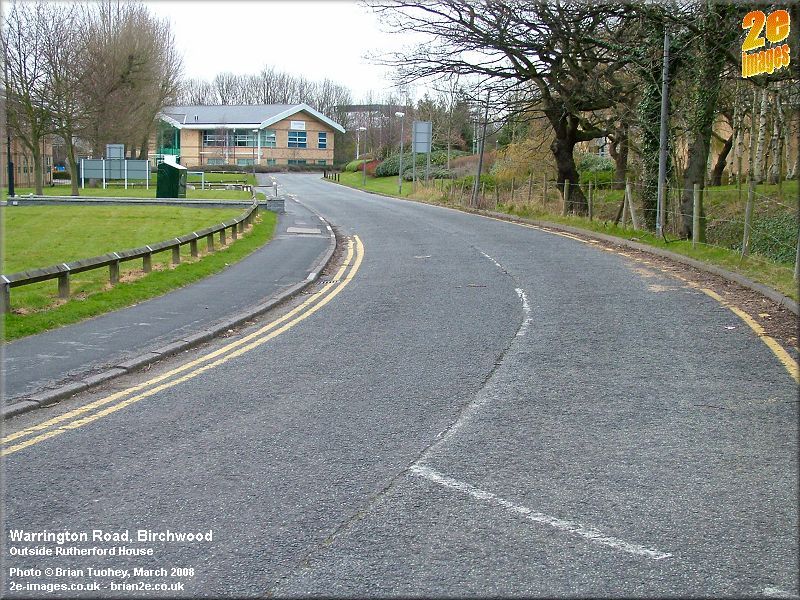
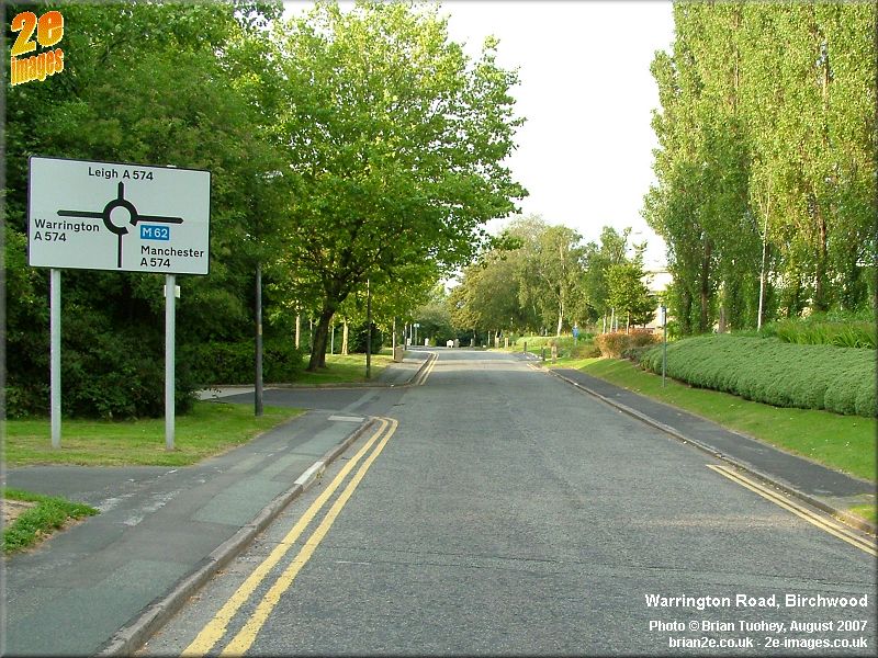
Garrett Field to Risley Roundabout Where the road turns and runs in front of Chadwick House, Warrington Road continues ahead, but for a short distance only as a footpath. After this point, it suddenly re-emerges as a road and then continues up to the roundabout where it meets Daten Avenue and Birchwood Park Avenue. On the left is the prestigious Rutherford House, constructed in 1979 as the headquarters of BNFL, although they have since moved their head office to Daresbury on the other side of Warrington. During 2007, the building was re-dedicated to Ernest Rutherford following the completion of its refurbishment in preparation for letting as office space. Beyond, Warrington Road continues through the commercial sector until it reaches the roundabout. About half way along, there is a right hand bend. At this point, there used to be an old farm lane off to the left. This was the original Lord's Lane, the other end of which can still be seen where Mill House Lane and Locking Stumps Lane meet, close to the present Lord's Lane. The roundabout stands on the site of the old Risley village school. As far as I know, it was still standing in the factory days, but it had been demolished by the early 1960s. The road then continues northwards, as the A574, to Culcheth and Leigh, passing the the northernmost part of the old factory, now the Trident Industrial Estate, where several old buildings survive to this day. For many years, they were used as a storage depot for The Admiralty. After this it passes the Noggin Inn and leaves Birchwood as it crosses over the M62.
|
|
Updated 11/10/11 |
|