Birchwood's
Business Parks
Birchwood's
Business ParksBirchwood Park, Science Park and Others
Birchwood's
Business Parks
Birchwood Park, Science Park and Others
| Contents
Page
Encounter All photographs on these pages are the property of the photographer Brian Tuohey. They may not be re-published in any form without written permission, but may be downloaded for personal use. Requests for commercial or charitable use of these or any other photographs will be considered. Please do not link directly to pictures, but links to this page are welcome. |
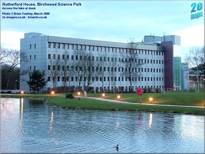
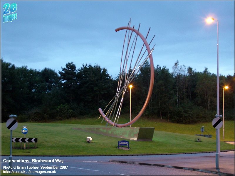
Connections | The Lake | Faraday Street | Warrington Road | Redevelopment Origins of the Business Parks The origins of the business parks in Birchwood to the north of Birchwood Way can be traced back to the end of the Second World War and the closure of the Royal Ordnance Factory (ROF) at Risley. In 1946, the UK Government set up various facilities around the country to support the new nuclear industry. One such site was a research facility based on part of the former Risley ROF site. These facilities were later brought together in 1954 under the umbrella of the newly formed United Kingdom Atomic Energy Authority (UKAEA). For the next half century, the development of the area that ultimately became Birchwood Park was closely associated with that of the UKAEA. Over the decades that followed, various changes took place in the role and in the organisation of the UKAEA that shaped the development of Risley and later of Birchwood. From 1965, the organisation was able to diversify into non-nuclear work, one of the first consequences being the establishment of the National Centre of Tribology. Later the Production Unit became part of the newly-formed BNFL and for a number of years, BNFL's head office was at Risley. Rutherford House was built in 1979 as the group's headquarters. As the growth in commercial activities continued, UKAEA's trading name was changed to AEA Technology and this part of the organisation was later privatised. Its role also changed, moving away from nuclear R&D to environmental restoration. Birchwood Park Birchwood Science Park Other Business Parks Connections Connections is the second sculpture within Birchwood from the design studios of Stephen Broadbent, the first being Encounter. It marks the southern and probably the main entrance to Birchwood Park and is a distinctive feature and landmark. It is located on the large roundabout built a few years ago at the junction of Birchwood Way and Faraday Street and was unveiled in 2003. There used to be a large warehouse on the right of Faraday Street heading northwards from the roundabout, next to Birchwood Way. It was part of the ROF and was known in UKAEA days as RD4. It was demolished in the early 2000's. Now, in 2008, a new hotel is being built on part of the site.
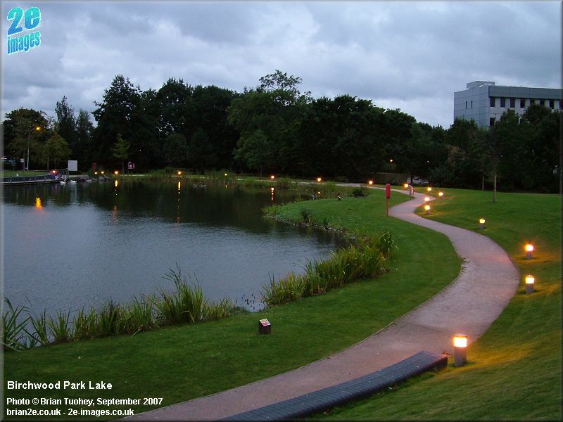
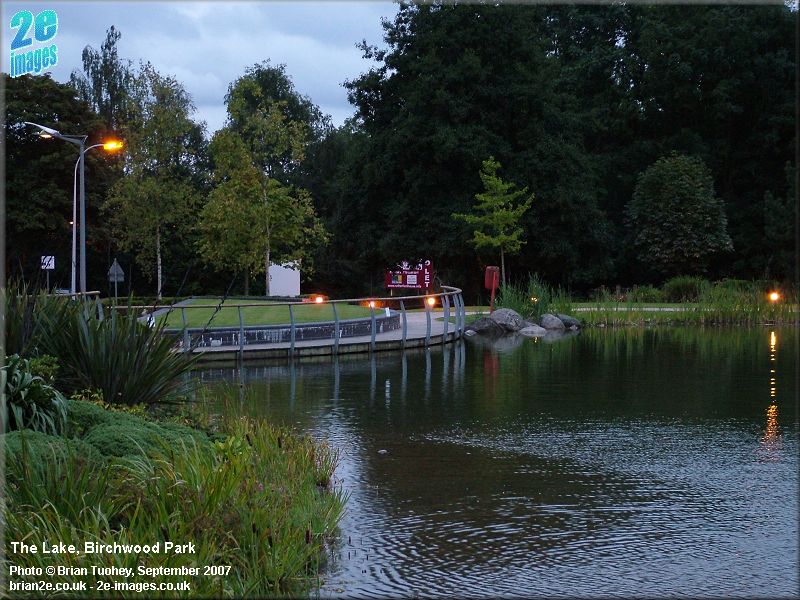
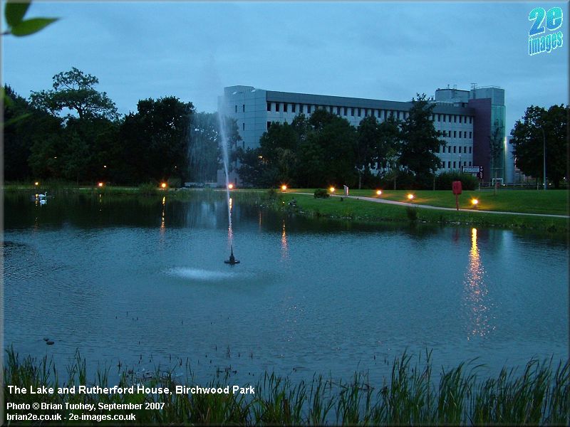
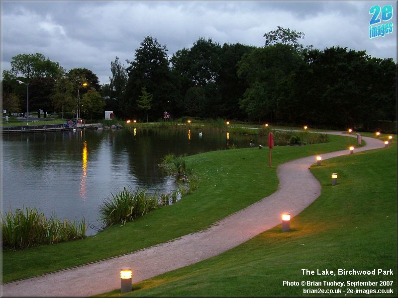
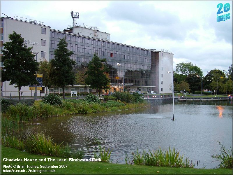
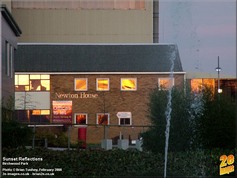
The Lake The Lake is a recent addition to the area, having been added as an attractive feature of the new business park. It is opposite the main entrance to Chadwick House and is next to the restaurant. It was officially opened in November 2001 and was named Moon Dazzle Lake by one of the local primary school children.
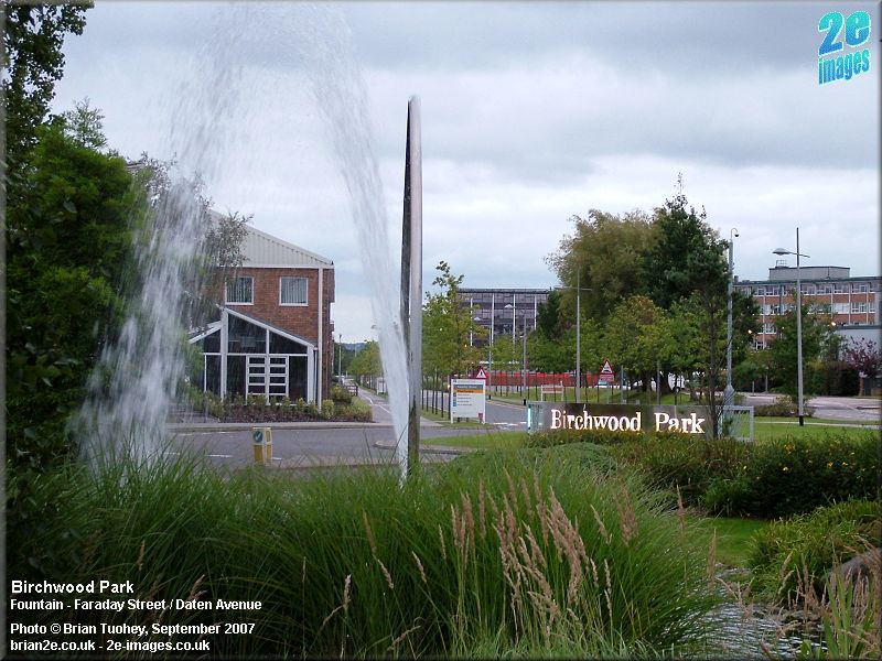
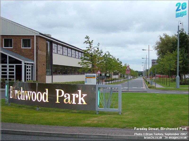
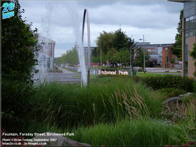
Faraday Street Faraday Street is of historical importance in the area because it is the longest continuous stretch of road that has survived from the ROF days, although only about half of it is still in existence today. Its northern end marks the northern entrance to Birchwood Park with the fountain at the roundabout on Daten Avenue. The journey south goes through the heart of the business park. Nowadays at its southern end, there is a sweeping curve to reach the new roundabout on Birchwood Way. Originally, it continued in a straight line to the southern end of the ROF site by the railway line, cutting across what is now Birchwood Way and bisecting the area that is now Oakwood. It would have crossed Admirals Road by the roundabout at Lyster Close. In the days of the ROF, road names in the factory were kept simple. Roads running north-south (NNW-SSE to be more accurate) were called Street 1, 2, 3, etc and those running east-west were Avenue A, B, C, etc. Faraday Street was Street 3 and Cavendish Avenue, seen on one of the pictures, was Avenue B, or more correctly Avenue B West, which continued eastwards, becoming Avenue B East, at the top end of the bunkers.
Warrington Road
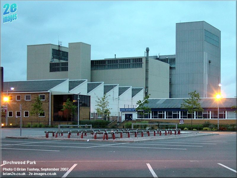
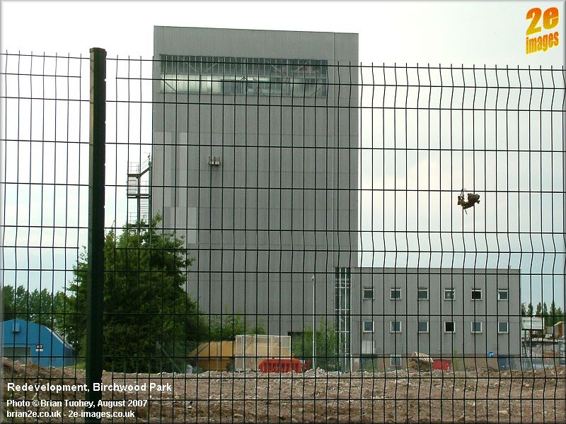
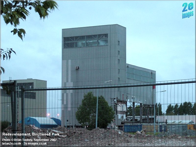
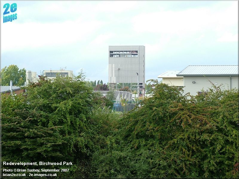
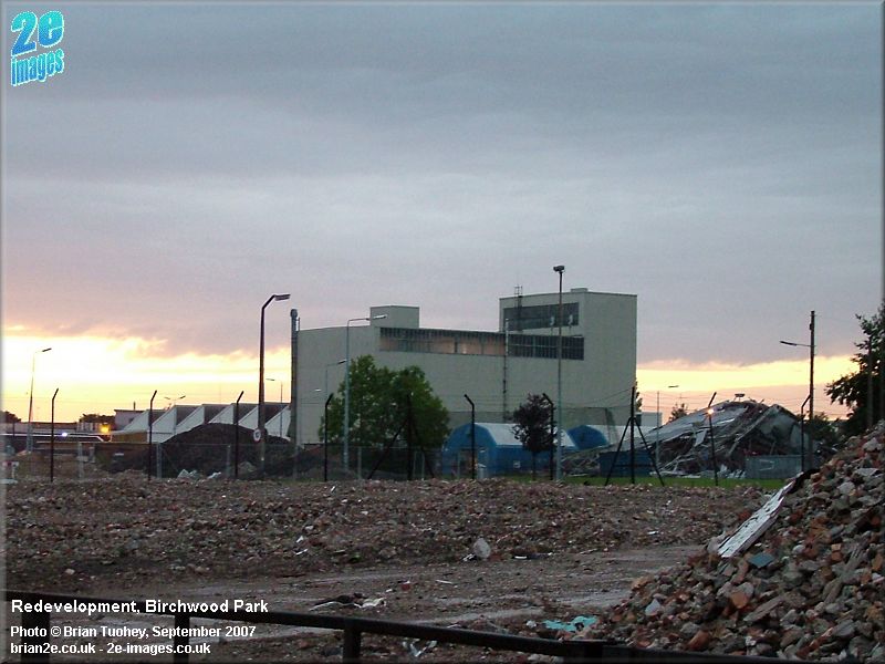
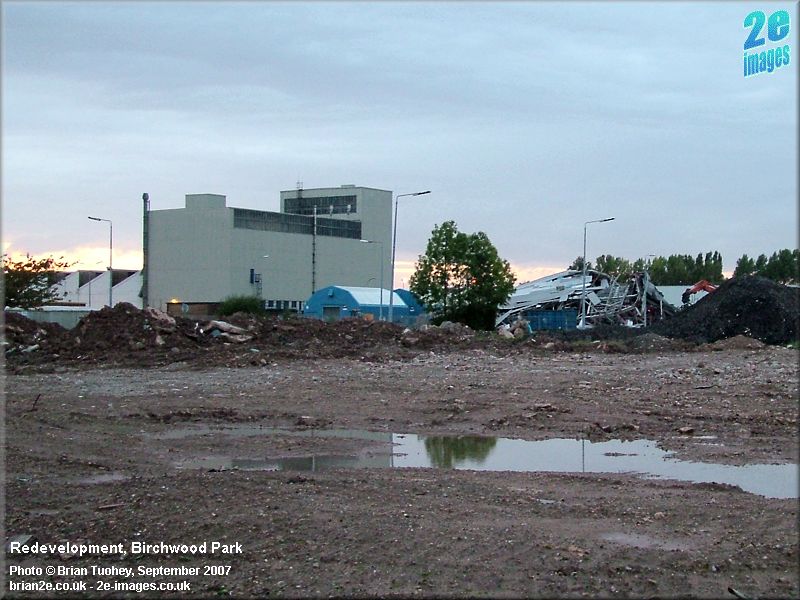
More information including the photos that were once on this page can be found on the Warrington Road page. Redevelopment The final gallery on this page shows some of the changes that were taking place during 2007 with the demolition of a building that was probably the tallest within the business park. It was certainly the easiest to spot from several miles away and could be seen ove the treetops from the Forest Park. During 2007, a large area on the north side of Cavendish Avenue including one of the old ROF buildings was cleared. The building shown here was slightly more recent, being purpose-built to house a UKAEA test rig. It was known as RD6. As far as I know, much of the work in constructing the Encounter sculpture took place in RD6. The final section, the tallest part, came down on 23rd September 2007. The pictures here were all taken in August and September 2007.
The four pictures below were taken on the weekend when the last part of the building finally came down. The first two were taken from the other side of Birchwood Way on the Saturday. The final two pictures show the scene at dusk on the Sunday, after the demolition was complete. The slightly smaller RD2 building alongside remains.
Another area currently being redeveloped is the site of the former RD4 building at the south end of the business park. It was a large old warehouse, named RD4 from its UKAEA days, although it was part of the former Royal Ordnance Factory. |
|
Updated 11/10/11 |
|