www.2e-images.co.uk
![]() 2E
Images Photography and Local History
2E
Images Photography and Local History
www.2e-images.co.uk
![]()
| Contents
Page
Encounter All photographs on these pages are the property of the photographer Brian Tuohey unless otherwise indicated. They may not be re-published in any form without written permission, but may be downloaded for personal use. Requests for commercial or charitable use of these or any other photographs will be considered. Please do not link directly to pictures, but links to the main gallery pages are welcome. |
Remnants
of Risley ROF
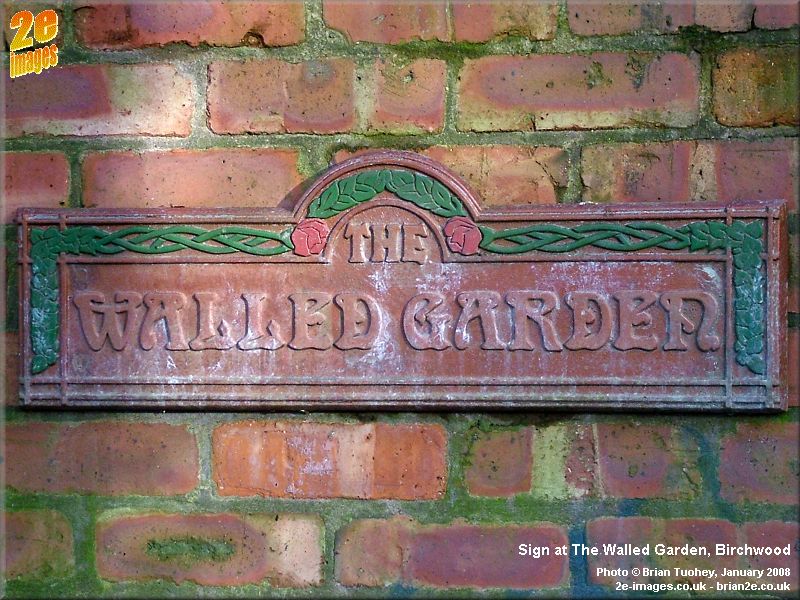
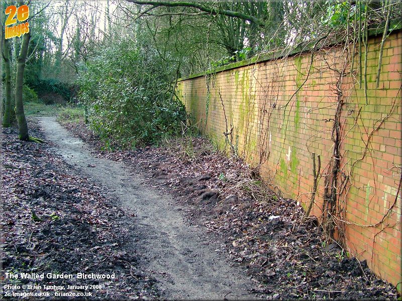
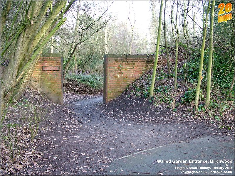
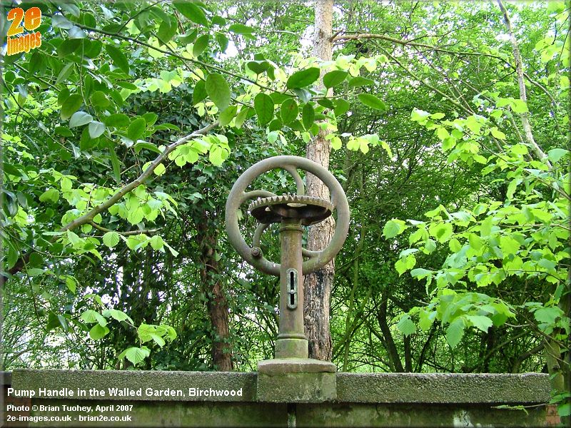
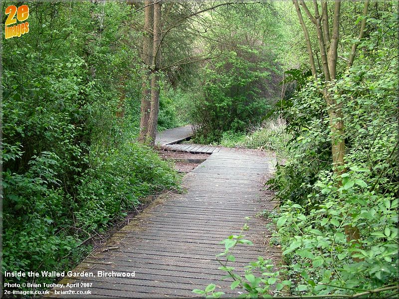
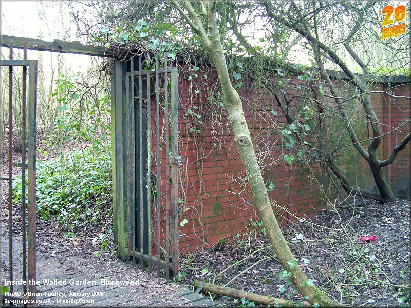
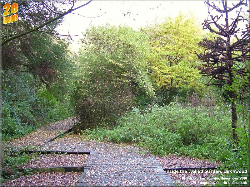
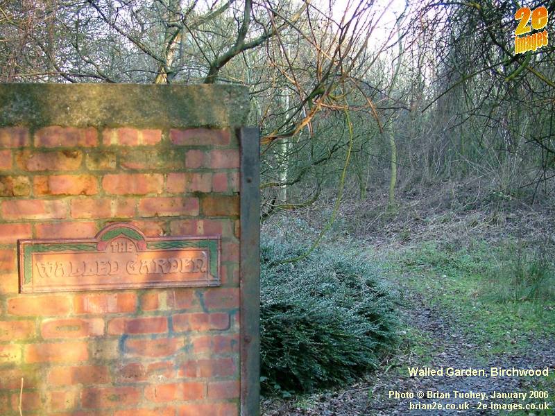
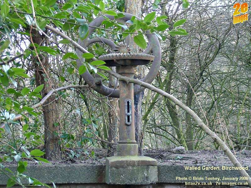
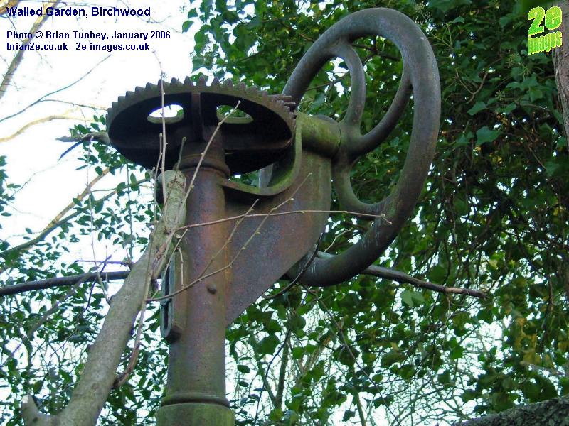
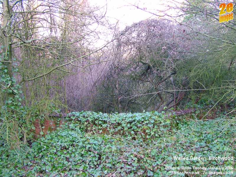
<<ROF Index || Introduction | Walled Garden | Pillbox | Business Park | Bunkers Introduction Today, Birchwood is a popular residential area and thriving business community on the edge of Warrington. Forty years ago, the area was very different, with much of what are now the residential areas being left derelict after the war. During World War II, a huge Royal Ordnance Factory had been built in the area. Prior to that, the village of Risley, as the area was then known, was a series of small farms scattered around Warrington Road. That all changed in 1938-39 when much of the farmland in the area and several farm buildings were compulsorily purchased in order to build the factory. Royal Ordnance Factories or ROFs were Government-owned establishments where munitions were manufactured. Several were built specifically for the war. Risley was one such factory. It closed down once the war was over and much of the site was left almost untouched until the 1960s. There were several different types of ROFs. Risley was one of 16 filling factories around the country and was known as Filling Factory No. 6. Others in the north west included Chorley (No. 1) and Kirkby (No. 7). During the redevelopment that created Birchwood, most of the remnants of the former Risley ROF were demolished and cleared, but a few pointers to the past remain. Since 2005, I have been photographing some of them and a selection of the pictures are shown on this page and on others. There is a separate page about the bunkers that are in Birchwood Forest Park. In the north of the area are several Business and Industrial Parks, including Birchwood Park and Trident. Amongst all the modern offices and other business premises, there are also several surviving examples of former ROF buildings. Within the residential areas of Oakwood and Gorse Covert, the signs of the area's past are more subtle, but they can still be found if you look carefully enough. The information on this page only describes a small fraction of the remaining signs of Birchwood's wartime history. Walled Garden The Walled Garden in the Oakwood Gate area was created from the former ROF Water Supply Reservoir Number 2. There was a pump house at one corner of the reservoir and the old sluice gate handle can still be seen today. As far as I know, this reservoir supplied water to the fire ring main that operated around the factory site. In the early 1980s the old reservoir was developed into a walled garden. In more recent years, it has gradually declined, but there are plans to improve it and bring it back to its former glory. As plans have developed, I have added more information on a new page all about Birchwood's Walled Garden.
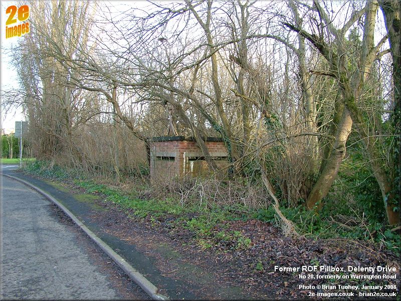
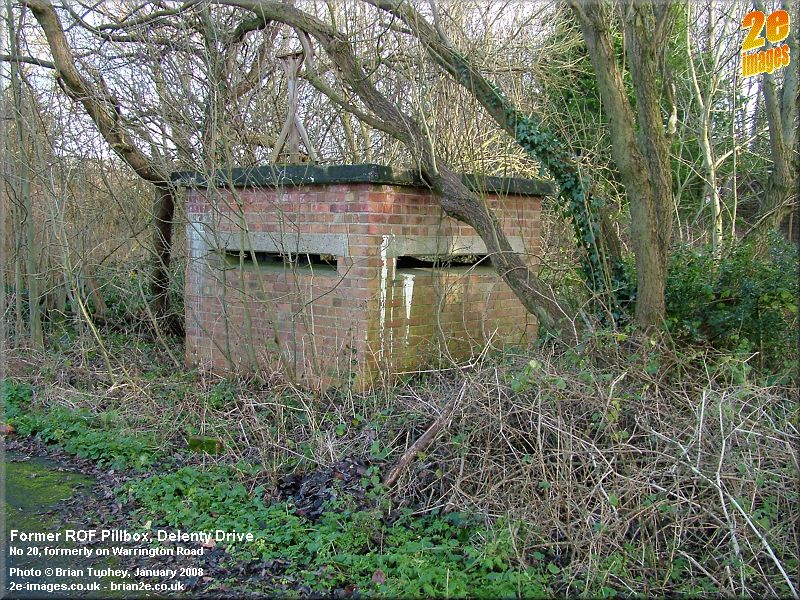
Reservoir 3 from the old factory was also nearby, on the site of the hill with the steps just across the main path. Reservoir 1 was in a completely different area of the site, by Silver Lane near one of the two boiler houses. Old Pillbox and Surrounding Area At intervals around and within the old factory site there were a number of pillboxes. As far as I know, only one still remains today. In modern day terms it is situated in Delenty Drive close to the Police Station. In wartime days, Delenty Drive was part of Warrington Road. The Police Station and the other buildings on that side of the road were all built for the factory, but were outside the area secured by the electric fencing. The Police Station was one of four houses in that area built for management at the factory and three of them still remain today, although two are now derelict, and the house immediately behind the pillbox is in a poor condition. Fernbank Close has since been built on the site of the 4th house. The other nearby flat roofed houses on Warrington Road were also built for factory officials and an air raid shelter survived in the back garden of one of the houses. There are also at least two hydrants in the area that were presumably served with water from Reservoir 2, above.
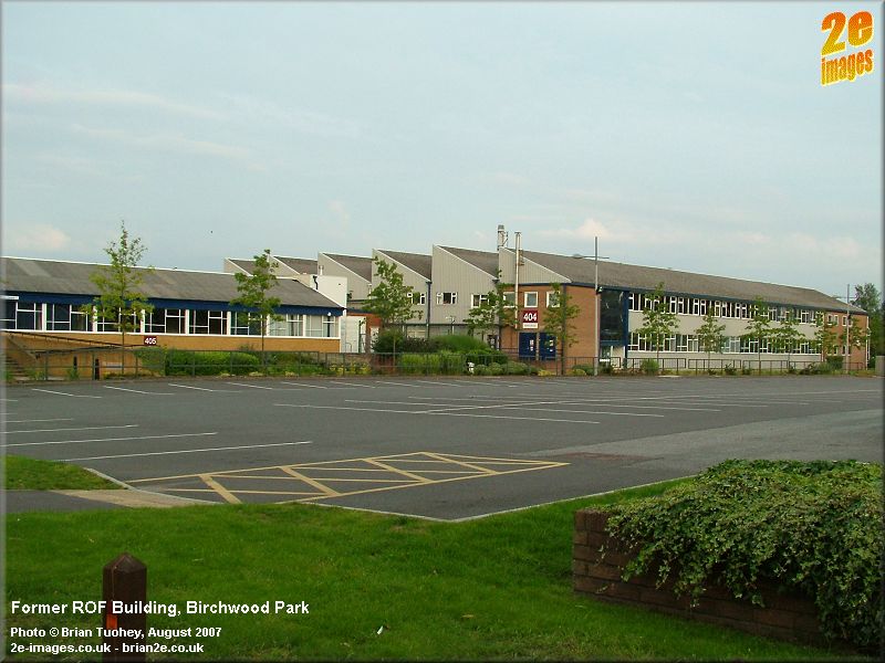
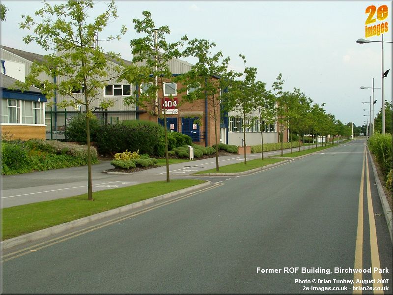
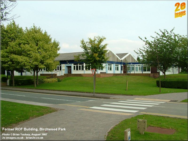
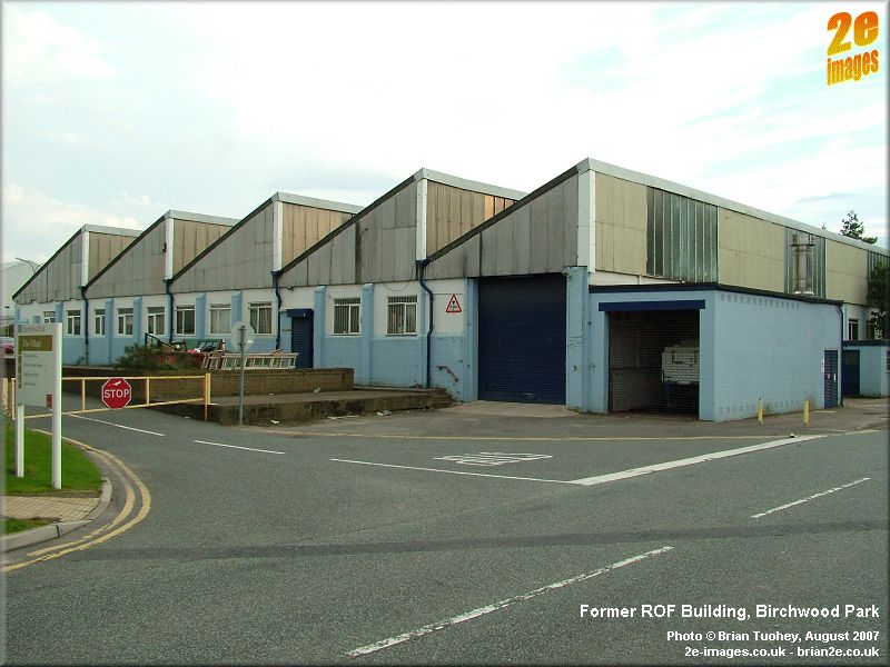
The road that runs between Delenty Drive and the Birchwood Way underpass was the start of Powell Avenue. Now that it has become a cul-de-sac with the expansion of Birchwood Park, I'm not certain whether it is still a named road. On the eastern side of its corner with Delenty Drive there was once a farmhouse with a barn behind it. The farm was called Wash End Farm and it is marked on a map that I have from the 1800s. In those days, the old lane that was partly made into Powell Avenue continued across several fields over what is now Oakwood, finishing on the edge of Woolston Moss. In today's terms, it finished on Admirals Road near Ashmore Close. Wash End Farm survived through the the ROF years and the site where the farmhouse and barn once stood is now a grassy area. Business Park After the war, part of the site was used by the nuclear industry. Some new buildings appeared, but in many cases, they were able to use the existing buildings from the ROF period. Whilst UKAEA have now moved away from the area, many of the private companies that were borne out of the business remain and much of the site is now managed as the Birchwood Park Business Park. The owners have made great efforts to make the area a pleasant environment in which to work and they are investing in new office, industrial and warehousing space. This means that more of the old ROF buildings are disappearing. A few of the buildings that date from the ROF period are pictured here.
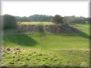
Most of the old buildings that remain are in use and over the decades their appearance has changed, sometimes the result of recladding, other times because they have been extended or altered. Those that were not being used have generally disappeared. Bunkers The storage bunkers which were a feature of all ROF Filling Factories are described in more detail and with plenty of photos on their own page. Click on the photo to go to the Bunkers page.
|
|
Updated 26/05/11 |
|